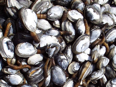
THE POTOMAC RIVER FISHERIES COMMISSION, having found it necessary for the preservation of the seafood resources and pursuant to its authority under Regulation I, Sections 8(a) and 7(a)(1):
HEREBY DECLARES AND ORDERS: the following described areas are closed to all soft shell clam harvest by any means at any time:
Closed Area – Upstream Limit
All waters of the Potomac River lying upstream of a line drawn from the U.S. Coast Guard Neale Sound entrance light number ”2” (Potomac River entrance to Neale Sound, MD) and the mouth of Popes Creek, VA.
Closed Area “A”
Eastern boundary – is the jurisdictional line of the Potomac River Fisheries Commission (PRFC) and the Maryland Department of Natural Resources (DNR), which is identified by sighting jurisdictional spar buoy “A” over the tip of Point Lookout.
Western boundary – is a line identified by sighting PRFC seed area marker “B” over Smith Creek Approach Light #2.
Closed Area “B”
Eastern boundary – is a line identified by sighting St. Mary’s River Junction Lighted Buoy over PRFC marker “PRIB.”
Western boundary – is a line extending due north from St. Mary’s River Junction Lighted Buoy.
Northern boundary – is a jurisdictional line of the PRFC and Maryland DNR at the mouth of St. Mary’s River, which is identified by sighting spar buoy M2C over PRFC marker “PRM2A.”
Closed Area “C”
Eastern boundary – is a line extending due south of Deep Point, St. George’s Island.
Western boundary – is a line identified by sighting St. George’s Creek West Channel Light #1 over the center span of the St. George’s Island Bridge.
Closed Area “D”
Eastern boundary – is a line extending due south of the mouth of Flood Creek.
Western boundary – is identified by sighting St. Clement’s Island Lighted Beacon #3 over St. Patrick Creek Approach Light #2.
Northern boundary – is the jurisdictional line of the PRFC and Maryland DNR at the mouth of Breton Bay as marked with PRFC markers “PRM3A, 3B and 3C: and spar buoys “3D” and “3E.”
Closed Area “E”
Eastern boundary – is a line identified by sighting the U.S. Coast Guard Potomac River channel buoy number “N-14” over a fixed marker on the southwest tip of St. Clement’s Island, MD, and the jurisdictional line of the PRFC and Maryland DNR across Dukeharts Channel as marked with PRFC markers “PRM4B and 4C.”
Western boundary – is a line identified by sighting St. Catherine Sound South Channel Light #1L over PRFC marker “PRM5A.”
Closed Area “F”
Western boundary – is a line identified by sighting spar buoy “V6D,” located on the Maryland-Virginia line at Nomini Bay, over the southern tip of Hollis Island.
Eastern boundary – is a line identified by sighting PRFC marker “PRV4B” over the north end of the tavern at Coles Point.
Closed Area “G”
Western boundary – is a line perpendicular to the shore five hundred (500) yards west of the entrance jetty to Bonums Creek.Eastern boundary – is a line perpendicular to the shore fifteen hundred (1500) yards east of the entrance jetty to Bonums Creek.
Closed Area “H”
Western boundary – is a line extending due east from Sandy Point Neck, which is identified by sighting the easternmost white boat house over a red gambrel roofed barn.
Eastern boundary – is a line extending Northeasterly from the western entrance to Cod Creek to U.S. Coast Guard buoy “#N-48B.”
Closed Area “I”
Western boundary – is a line perpendicular to the shore from the entrance to Hack Creek to U.S. Coast Guard buoy “#N-45B.”
Eastern boundary – is a line perpendicular to the shore approximately four thousand (4000) yards below the western boundary opposite a white house.
Closed Area “J”
Eastern boundary – is a line identified by sighting the U.S. Coast Guard Potomac/Wicomico River Junction buoy (red/black num buoy) over the U.S. Coast Guard Wicomico River red daybeacon “#2W” (Mouth of the River Bar).
Western boundary – is a line identified by sighting the tip of Cobb Point (Cobb Island) over the U.S. Coast Guard Wicomico River flashing green light “#3W” (Shipping Point).
Northern boundary – is the jurisdictional line of the PRFC and Maryland DNR at the Mouth of the Wicomico River as marked with PRFC marker “PRM6A,” Cobb Bar Light, and “PRM6B.”
Closed Area “K”
All of the waters of Piney Point Hollow beginning at a point, defined by Lat. 38°08.148’N and Long. 76°30.217’ W and marked with a buoy;
Thence, running NW’trly approximately 306° true to a point, defined by Lat. 38°08.343’ N and Long. 76°30.557’ W and marked with a buoy;
Thence, running NE’trly approximately 41° true to a point at or near the mean low water line of the shore, defined by Lat. 38°08.428’N and Long. 76°30.463’ W;
Thence, running SE’trly approximately 110° true to a point at or near the mean low water line of the shore, defined by Lat. 38°08.340’ N and Long. 76°30.153’ W;
Thence, running SW’trly approximately 194° true to the point of beginning.
Conditionally Closed Area – The area south and/or east of the Upstream Limit and north and/or west of the Charles – St. Mary’s County line is closed for clamming April 1 through October 31 each year.
Notice: ALL Closed areas extend from the mean low water line off shore to the Channel, unless otherwise noted.
BE lT FURTHER DECLARED AND ORDERED: that this Order #2003-12 shall become effective October 6, 2003 and will remain in effect until further notice.
